Geospatial data is where it all begins.
You might think, “What is geospatial data, and why do I need to understand it?”
It’s more than simply location, location, location. It’s about identifying patterns, correlations, and trends in a phenomenon.
Geospatial data is information that has a geographical reference and defines where an object or phenomenon is on the Earth’s surface. It may contain data about points, lines, and areas, as well as attribute data that offers more information about each location.
In this post, we’ll explore what geospatial data is, why it’s essential to understand, how we use it in our everyday lives, and how it may help us solve complex problems.

Contents
- 1 The Importance of Geospatial Data
- 1.1 Types of Geospatial Data
- 1.2 Geospatial Data Formats
- 1.3 Coordinate Systems and Projections
- 1.4 How Geospatial Data is Collected
- 1.5 Sources of Geospatial Data
- 1.6 Applications of Geospatial Data
- 1.6.1 Environmental Monitoring and Conservation
- 1.6.2 Urban Planning and Smart Cities
- 1.6.3 Agriculture and Precision Farming
- 1.6.4 Disaster Management and Emergency Response
- 1.6.5 Public Health and Disease Control
- 1.6.6 Infrastructure Development
- 1.6.7 Archaeology and Cultural Heritage
- 1.6.8 Telecommunications
- 1.6.9 Real Estate and Property Development
- 1.7 Challenges in Working with Geospatial Data
- 1.8 Future Trends in Geospatial Data
- 1.9 Wrap Up
- 1.10 FAQs
What is Geospatial Data?
Geospatial data, also known as spatial data, geographic data, or geodata, is data that contains information about its location on Earth. It can be mapped using a coordinate system.
Definition of Geospatial Data
Geospatial data describes objects, events, or other features with a location on or near the Earth’s surface.
It combines location information (usually coordinates on the Earth) with attribute information (the characteristics of the object, event, or phenomena concerned) and temporal information (the time or life span at which the location and attributes exist).
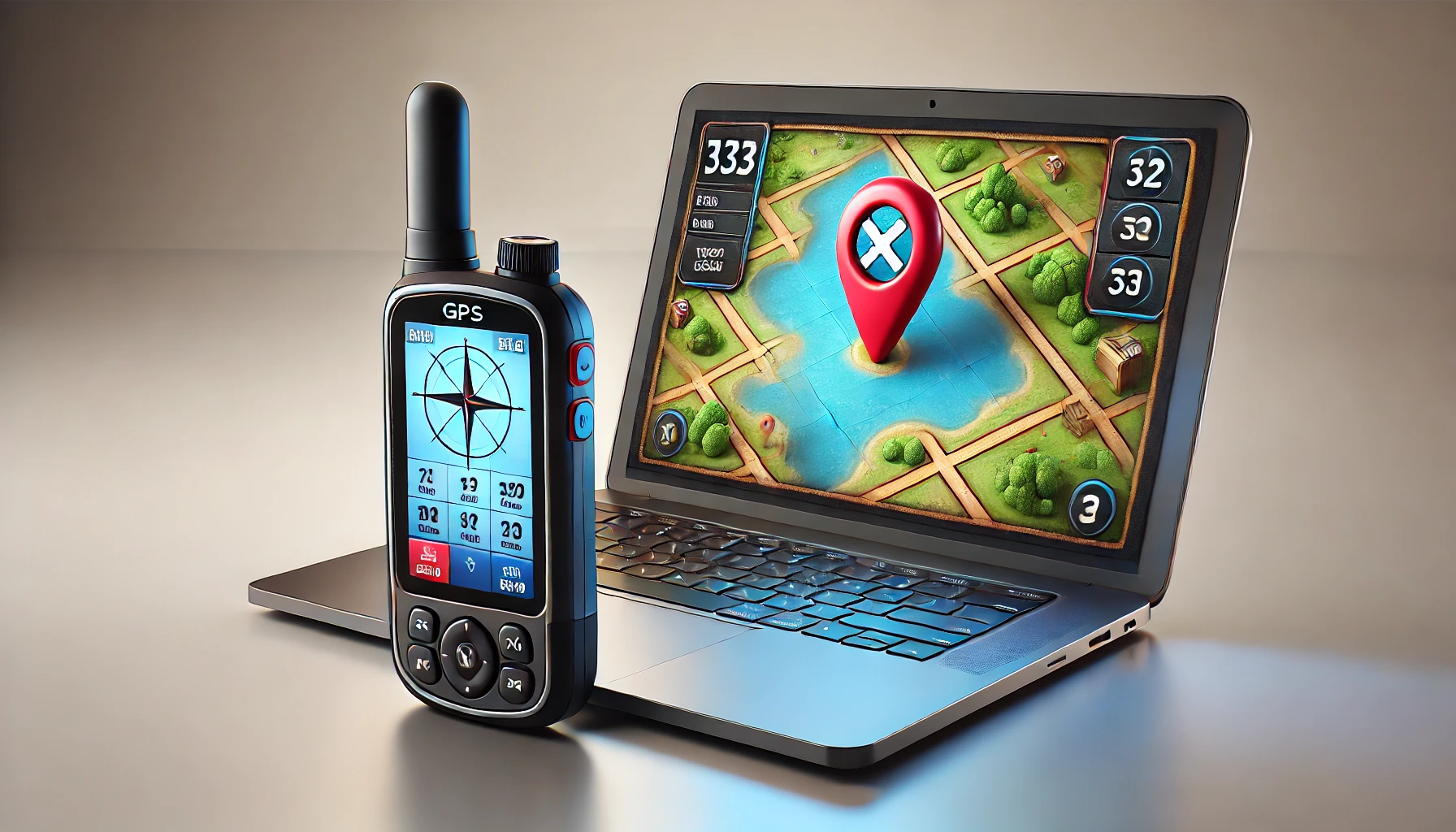
Think of it as a treasure map.
The graphical data represents the “X” that marks the site, while the attribute data describes the treasure hidden there.

The key difference between spatial and non-spatial data lies in the presence of geographic coordinates. While non-spatial data might tell you what something is, spatial data tells you both what it is and where it is.
Spatial vs Non-Spatial Data
Spatial data includes information about the location of objects or events on the Earth’s surface.
In contrast, non-spatial data does not include location information. However, sometimes it can still be linked to spatial data through attributes.
Why Do We Need to Care About Geospatial Data?
Let’s address the most pressing concern on everyone’s mind before delving into the meaty specifics of geographical data: Why do we need to comprehend it?
Here’s what I think:
- Because geospatial data is widely available!
- Because geospatial data displays more than just a location.
Geospatial Data is Everywhere!
Have you ever used your phone’s Maps app to determine the fastest route to a new location? You’ve successfully worked with geographic data.
Or you asked a friend to share their location with you on WhatsApp. Yes, more geographic data—you guessed it.
More data than ever before is available thanks to the development of technology and the Internet of Things.
90% of the data that is currently available was created in just the last two years, according to a 2013 article from the website sciencedaily.com.
The amount of data that is available today is astounding. And here’s the mind-blowing part: about 80% of that data has a location reference—geospatial data.
Geospatial Data Displays More Than Just a Location
Location isn’t the only factor.
Geospatial data can display a phenomenon’s trends, linkages, and patterns. And with that information, we can respond to a wide range of space-related (and time-related) queries.
I’ll give you an illustration.
Look at the picture below.

The right image displays the same data in a geographically displayed format, whereas the left image is just a table.
The right image showed more information: location, pattern, and relationship of a phenomenon.
Always remember, that geospatial data isn’t just about location. Understanding and analyzing it will enable us to uncover an enormous amount of information and solve complex problems.
The Importance of Geospatial Data
Geospatial data is used in various aspects of daily life, such as navigation systems, weather forecasting, and social media platforms that use geotagged posts.
By providing insights into spatial relationships and patterns, geospatial data helps in making informed decisions across industries.
For instance, it aids in urban planning by analyzing population distribution and land use patterns
Types of Geospatial Data
Spatial data comes in various forms, each with its characteristics and uses. Let’s explore the main types: Vector and Raster data.
Vector Data
Vector data represents the world using points, lines, and polygons. It’s ideal for representing discrete objects with precise shapes and locations.
Vector data is a type of spatial data that is depicted with points or points connected to a Cartesian diagram (coordinates) to form features such as points, lines, and polygons.
Take a look at the example and explanation of vector data below:

Imagine a coordinate system with X and Y axes. The X-axis runs east-west, and the Y-axis runs north-south. These axes intersect above the Earth’s surface, representing locations in a grid-like fashion.
The distance along the X and Y axes can be measured in meters or degrees to establish a point’s precise location. The equator serves as the 0 point for the Y-axis, while Greenwich is the 0 point for the X-axis.

Vector data can be divided into several types:
- Point: A single location on the Earth’s surface.
- Line: A series of connected points, such as a road or river.
- Polygon: A closed shape formed by a series of connected lines, such as a country or province boundary.
Vector data characteristics:
- Composed of vertices and paths
- Efficient for storing data that has discrete boundaries
- Easily scalable without losing definition
Examples:
- Points: Cities, trees, wells
- Lines: Roads, rivers, contour lines
- Polygons: Lake boundaries, property parcels, administrative areas
Raster Data
Raster data represents the world as a surface divided into a regular grid of cells. Each cell contains a value representing information, such as temperature, elevation, or spectral data. Raster data is a type of geospatial data that is depicted with a grid (cell) or pixel structure, where each pixel shows one value.
Imagine an area with varying heights across different locations. Now, visualize dividing this area into 100 m × 100 m square plots, connected like a chessboard.
Using these plots, we calculate the average height for each one. The “value” for each tile is determined by this average height.
These tiles are often referred to as pixels or grids. The value assigned to each pixel corresponds to the height within that specific tile. The accuracy of the data is reflected in the pixel size.

Attribute Data
Attribute data is non-spatial information that’s linked to spatial features. It provides additional information about the characteristics of geographic entities, such as population data, land use types, or traffic volume.
Other Types of Geospatial Data
- Point Cloud Data: Point cloud data consists of a set of data points in space, usually produced by 3D scanners or LiDAR (Light Detection and Ranging) systems. This type of data is crucial for detailed 3D modeling and is often used in applications like terrain mapping and building reconstruction.
- Temporal Data: Temporal data adds the dimension of time to spatial information, allowing for the analysis of changes over time. This is vital for understanding dynamic processes like seasonal vegetation changes or urban growth patterns.
Understanding these different types of geospatial data is crucial for choosing the right data type for your specific needs and analysis.
Geospatial Data Formats

There are several different formats for geospatial data, all of which are intended to effectively store and display spatial data. Let’s look at a few of the most popular formats:
Raster Formats
Raster formats are used to store grid-based data. Common raster formats include:
- GeoTIFF: A standard image format that includes additional spatial metadata. It’s widely used for satellite imagery and aerial photos.
- JPEG2000: An image compression standard that supports lossy and lossless compression. It’s useful for large datasets where file size is a concern.
- HDF (Hierarchical Data Format): A format designed to store and organize large amounts of numerical data. It’s often used for scientific datasets.
Vector Formats
Vector formats store data as geometric shapes. Common formats include:
- Shapefile: An extensively used format created by Esri. The shape and characteristics of spatial features are collectively stored in a number of files (.shp, .shx, .dbf, etc.) that make up this system.
- GeoJSON: A JSON-based lightweight format perfect for online apps. Both computers and humans can read it with ease.
- KML (Keyhole Markup Language): An XML-based format utilized by Earth browsers such as Google Earth to display geographic data.
Database Formats
Spatial databases allow for efficient storage and querying of geospatial data:
- PostGIS: An extension for the PostgreSQL database that adds support for geographic objects.
- SpatiaLite: A spatial extension for SQLite, providing a lightweight option for spatial databases.
Web Mapping Formats
These formats are designed for efficient data transfer and rendering in web applications:
- WMS (Web Map Service): A standard protocol for serving georeferenced map images over the internet.
- WFS (Web Feature Service): Allows retrieval and updating of geospatial data encoded in Geography Markup Language (GML).
Point Cloud Formats
For storing 3D point cloud data:
- LAS: The industry-standard binary format for storing airborne lidar data.
- LAZ: A compressed version of LAS, significantly reducing file sizes.
Choosing the right format depends on your data type, analysis needs, and the software you’re using. It’s often necessary to convert between formats, and many GIS tools provide this functionality.
Coordinate Systems and Projections
Understanding coordinate systems and map projections is crucial for accurate spatial analysis.
Geographic Coordinate System (GCS)
The GCS uses latitude and longitude coordinates to pinpoint locations on the Earth’s surface. It accounts for the Earth’s curvature, ensuring accurate spatial representation.
Projected Coordinate Systems (PCS)
PCS transforms the GCS into a 2D plane for easier mapping. Common projection types include UTM (Universal Transverse Mercator) and Mercator. These projections help in spatial analysis by simplifying complex geographic relationships.
Datum
A datum is a reference system that defines the coordinate system and spatial reference information for a GIS dataset. Common datums include WGS84 (World Geodetic System 1984) and NAD83 (North American Datum 1983). These datums ensure that spatial data is accurately referenced and aligned.
Map Projections
Map projections impact spatial analysis and map interpretation by distorting or preserving certain aspects of the Earth’s surface. Understanding these projections is crucial for accurate geospatial analysis.
How Geospatial Data is Collected

Geospatial data is collected using a variety of methods, each contributing to a comprehensive understanding of the Earth’s surface. Here’s an overview of the primary collection techniques:
1. Remote Sensing
Remote sensing captures data from satellites and aircraft, using advanced sensors to gather information across various wavelengths.
- Satellite Imagery: High-resolution satellites capture images of the Earth, monitoring land use changes, natural disasters, and large-scale environmental phenomena like deforestation. Examples include NASA’s Landsat, ESA’s Sentinel, and commercial satellites from Maxar Technologies.
- Aerial Photography: Captured by cameras mounted on airplanes or drones, aerial imagery provides detailed mapping data, essential for urban planning, agriculture, and disaster response.
- LiDAR (Light Detection and Ranging): Uses laser pulses to generate precise 3D models of terrain, vegetation, and structures. LiDAR is especially valuable for creating digital elevation models (DEMs) and mapping hidden archaeological sites.
- Optical Sensors: Collect visible and infrared light data for vegetation monitoring and urban analysis.
- Radar Systems (SAR): Penetrate clouds and darkness, ideal for topography and deforestation monitoring in all weather conditions.
- Thermal Sensors: Detect heat emissions, useful for monitoring urban heat islands, volcanic activity, and other temperature-related phenomena.
2. GPS and GNSS Data Collection
GPS and other Global Navigation Satellite Systems (GNSS) are crucial for accurate location data, providing precise positioning, navigation, and timing information.
- Surveying with GPS: Surveyors use GPS devices to collect geospatial data with high accuracy, essential for mapping land boundaries, infrastructure, and natural features. This data often integrates with GIS software to create detailed maps and models.
- Mobile GPS Applications: Smartphones and mobile devices with GPS enable real-time geospatial data collection for various applications, from mapping trails and recording wildlife observations to tracking delivery routes and monitoring fleet movements.
3. Field Surveys and Ground-Based Methods
Traditional field surveys and direct measurements remain vital for collecting high-precision geospatial data.
- Total Stations and Theodolites: Precision instruments for measuring distances, angles, and elevations; indispensable in construction, cadastral mapping, and terrain surveys.
- Ground Penetrating Radar (GPR): Non-invasive subsurface imaging used in archaeology, geology, and infrastructure maintenance to detect buried objects and voids.
4. Drones and UAVs
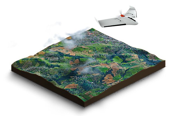
Drones, or Unmanned Aerial Vehicles (UAVs), have revolutionized geospatial data collection, providing high-resolution imagery and 3D models quickly and efficiently.
- Aerial Surveys: Drones equipped with cameras and sensors capture detailed data over large areas, used extensively in agriculture, environmental monitoring, and disaster response.
5. Crowdsourcing and Volunteered Geographic Information (VGI)
Crowdsourcing leverages contributions from individuals to create detailed geospatial datasets.
- OpenStreetMap (OSM): Volunteers contribute data on roads, buildings, and other features, making OSM a valuable resource, especially in areas lacking official maps.
- Citizen Science Projects: Platforms like iNaturalist and eBird gather data on wildlife and environmental conditions, enriching global geospatial databases.
- Social Media Geotagging: User-generated location data from platforms like Twitter is analyzed for insights into urban development, social behavior, and disaster response.
6. Automated and Real-Time Data Collection
The Internet of Things (IoT) and other technologies have enabled real-time geospatial data collection, vital for smart cities, environmental monitoring, and disaster management.
- IoT Sensors: Continuous data collection from IoT devices monitors air quality, traffic flow, energy consumption, and water levels. This real-time data is integrated into GIS platforms for analysis and decision-making.
- Telematics and Fleet Management: In transportation and logistics, telematics systems gather real-time data on vehicle locations, driving behavior, and route efficiency, optimizing fleet management and reducing fuel consumption.
- Weather Stations and Environmental Sensors: Automated weather stations and sensors collect data on temperature, humidity, wind speed, and more, crucial for weather forecasting, climate research, and agricultural planning.
Sources of Geospatial Data
Geospatial data is available from various sources, each offering unique datasets for different applications. Let’s break it down:

Cloud-based Platforms (Google Earth Engine and Microsoft Planetary Computer)
Cloud-based platforms like Google Earth Engine (GEE) and Microsoft Planetary Computer provide vast repositories of geospatial data that are easily accessible and scalable.
These platforms offer tools for analyzing and visualizing data without needing extensive local resources, making them invaluable for researchers and analysts.
- Google Earth Engine: Ideal for large-scale environmental data analysis.
- Microsoft Planetary Computer: Excellent for global-scale datasets and environmental modeling.
Government Agencies
Government agencies are a goldmine for reliable geospatial data, often available at no cost. In the U.S., the U.S. Geological Survey (USGS) and the National Oceanic and Atmospheric Administration (NOAA) provide extensive datasets.
- USGS Earth Explorer: Great for accessing satellite imagery and aerial photography.
- NOAA: Offers data related to weather patterns and coastal mapping, essential for environmental science and emergency management.
Academic Institutions
Universities and research institutions often make their geospatial data publicly available. Academic portals like the Harvard Geospatial Library provide access to diverse datasets, from demographics to land use.
- Harvard Geospatial Library: Offers a wide range of datasets for research and analysis.
- University GIS Portals: Ideal for academic and research-based geospatial data.
OpenStreetMap and Crowdsourced Data
OpenStreetMap (OSM) is a standout example of crowdsourced geospatial data. Volunteers around the world contribute detailed data, making OSM an invaluable resource for mapping projects, especially in areas lacking official datasets.
- OpenStreetMap: Excellent for detailed, user-generated geographic data.
- Crowdsourced Platforms: Valuable but always verify accuracy.
Commercial Data Providers
For specialized datasets, commercial data providers like SafeGraph and Esri offer tailored databases for businesses and market analysis.
- SafeGraph: Provides data on points of interest (POI) for market analysis.
- Esri: Known for its GIS software and offers a range of datasets via ArcGIS Online.
International Organizations
International organizations such as the United Nations and the World Bank offer global datasets, crucial for large-scale studies and development projects.
- United Nations Geospatial Information Section: Provides datasets related to sustainable development goals.
- World Bank: Offers comprehensive economic and demographic data that can be mapped geospatially.
Applications of Geospatial Data

Geospatial data is a game-changer in many industries, transforming the way we approach everything from environmental conservation to urban planning.
Coupling with geospatial modelling, let’s dive into some key areas where geospatial data is making a big impact.
Environmental Monitoring and Conservation
Geospatial data is crucial for tracking environmental changes like deforestation, glacier retreat, and urban sprawl. It allows scientists and policymakers to monitor ecosystems, assess human impact, and plan conservation efforts.
For example, satellite data helps track the Amazon rainforest’s deforestation in near real-time, enabling quick action to protect these vital areas.
Urban Planning and Smart Cities
Urban planners use geospatial data to design more efficient and sustainable cities. It’s all about optimizing land use, designing transportation networks, and ensuring that public services are accessible.
In smart cities, geospatial data from IoT devices is analyzed to improve urban management, like reducing traffic congestion or planning new infrastructure.
Agriculture and Precision Farming
Geospatial data has revolutionized agriculture with precision farming. By monitoring crop health, soil conditions, and weather patterns, farmers can make data-driven decisions that boost efficiency and reduce waste.
For example, satellite imagery helps farmers identify areas that need more water or fertilizer, optimizing resource use and improving yields.
Disaster Management and Emergency Response
In disaster management, geospatial data is indispensable. It’s used to predict, respond to, and recover from natural disasters like hurricanes and floods.
For instance, real-time geospatial data during a flood can help authorities monitor water levels, predict which areas are at risk, and plan evacuations, ensuring that resources are deployed where they’re needed most.
Public Health and Disease Control
Geospatial data is also making waves in public health. It tracks disease outbreaks, identifies high-risk areas, and allocates healthcare resources effectively.
During the COVID-19 pandemic, geospatial data was essential for tracking the virus’s spread and planning vaccination campaigns.
Infrastructure Development
Geospatial data plays a vital role in planning and monitoring infrastructure projects.
It helps engineers and planners create accurate site maps, analyze terrain, and assess environmental impacts before construction begins. This ensures that projects stay on track and within budget.
Archaeology and Cultural Heritage
In archaeology, geospatial data is a powerful tool for discovering and preserving ancient sites.
Remote sensing technologies like LiDAR reveal structures hidden under vegetation, while 3D models created from geospatial data help document and conserve heritage sites, ensuring they’re preserved for future generations.
Telecommunications
Telecom companies rely on geospatial data to optimize network coverage and plan infrastructure.
It’s used to create heat maps of signal strength, helping pinpoint areas where additional cell towers are needed.
This is especially crucial as companies roll out 5G networks, which require precise placement of small cells to ensure seamless coverage.
Real Estate and Property Development
Geospatial data is a key player in real estate for site selection, feasibility studies, and market analysis.
Developers use it to assess potential sites, considering factors like topography and proximity to amenities.
It’s also invaluable for property valuation, helping real estate professionals determine the fair market value based on location and neighborhood trends.
Challenges in Working with Geospatial Data

Working with geospatial data offers incredible opportunities, but it also comes with its own set of challenges. Let’s break down some of the key hurdles you might encounter.
Data Accuracy and Quality
One of the biggest challenges is ensuring the accuracy and quality of geospatial data. Since data comes from various sources—like satellites, drones, and ground surveys—the accuracy can vary widely.
Inaccurate data can lead to bad decisions, like poorly placed infrastructure or misguided conservation efforts. Validating data through cross-referencing or ground-truthing is essential to avoid these pitfalls.
Data Privacy Concerns
Geospatial data often includes location-specific information that can raise privacy concerns. For instance, location data from mobile apps could reveal sensitive details about a person’s movements.
It’s crucial to have strong data governance policies in place and anonymize data when possible to protect privacy while still leveraging the power of geospatial data.
Technical Challenges and Data Management
Handling geospatial data can be technically demanding, especially with large datasets. High-resolution images and detailed 3D models require significant storage and processing power.
Plus, integrating data from multiple sources—each with different formats—can be a real headache.
Using cloud-based solutions and having effective data management strategies are key to overcoming these technical hurdles.
Interoperability Issues
Interoperability is another common challenge.
Geospatial data often comes in various formats, and making these different datasets work together can be tricky.
For example, combining vector data from GIS with raster data from satellite images might require complex conversions.
Standardizing data formats and using compatible systems can help ease these issues, but it’s not always straightforward.
Legal and Ethical Considerations
Legal and ethical issues are also a big part of working with geospatial data.
Questions around data ownership, licensing, and the ethical use of data need to be carefully managed.
For example, using data without the proper licenses could lead to legal trouble, and using geospatial data for surveillance raises significant ethical concerns.
Data Volume and Complexity
The sheer volume and complexity of geospatial data can be overwhelming.
With the rise of big data, managing and analyzing geospatial data requires advanced tools and specialized skills.
For instance, analyzing real-time data from IoT devices in a smart city demands not only processing power but also the ability to handle and interpret vast amounts of information quickly and accurately.
Future Trends in Geospatial Data

The field of geospatial data is rapidly evolving. Here are some key trends to watch:
Artificial Intelligence and Machine Learning
AI and ML are transforming how we process and analyze geospatial data.
Automated feature extraction, predictive analytics, and natural language processing are just a few ways these technologies enhance geospatial data analysis.
Real-time Geospatial Data
Advancements in IoT and 5G are enabling real-time geospatial applications, such as smart cities, precision agriculture, and emergency response.
Augmented Reality (AR) and Virtual Reality (VR)
AR and VR are creating new ways to interact with geospatial data, from urban planning visualizations to immersive training simulations.
Geospatial Blockchain
The use of blockchain technology to secure and validate geospatial data is an emerging trend.
Blockchain ensures data integrity and transparency, which is essential for trustworthiness in applications such as land registration and property transactions.
Wrap Up
Geospatial data has become an indispensable tool in our increasingly connected and data-driven world.
From helping us navigate our daily commutes to addressing global challenges like climate change, the applications of geospatial data are vast and growing.
Key points to remember:
- Geospatial data combines location information with attributes, providing a powerful way to understand our world.
- Various types of geospatial data exist, each with its strengths and applications.
- Collecting, analyzing, and visualizing geospatial data requires specialized tools and expertise.
- Challenges like data quality, privacy, and interoperability must be addressed for effective use of geospatial data.
- The field is rapidly evolving, with trends like AI, real-time data, and AR/VR shaping its future.
FAQs
- What is geospatial data used for?
- Geospatial data is used for urban planning, environmental monitoring, disaster management, agriculture, healthcare, transportation, and more.
- How is geospatial data collected?
- Geospatial data is collected from sources like satellite imagery, aerial photography, GPS, surveys, and crowdsourced data.
- What is the difference between raster and vector data?
- Raster data consists of grid cells or pixels, while vector data is composed of discrete features like points, lines, and polygons.
- What are the challenges in working with geospatial data?
- Challenges include data accuracy, privacy concerns, technical difficulties, and interoperability issues.
- How does GIS technology use geospatial data?
- GIS technology uses geospatial data to manage, analyze, and visualize spatial information for decision-making.
- What is the future of geospatial data?
- The future includes advancements in satellite imaging, AI, machine learning, and big data analytics.