Ever wondered why there are so many different types of maps and which one to use?
Did you know that there are many map types, each designed to serve a specific purpose?
From navigating through unfamiliar territories to understanding complex data, maps have become an essential tool in our daily lives. The term “types of maps” refers to the diverse map categories, each with its unique characteristics and uses.
Maps play a crucial role in navigation, research, and decision-making.
Whether you’re planning a hike or trying to understand global climate patterns, the right type of map can make all the difference.
This guide delves into the various types of maps available, helping you understand their uses and how they can serve your specific needs.
Contents
What Are Some Types of Maps?
The Intergovernmental Committee on Surveying and Mapping (ICSM) provides a widely recognized map classification, often referenced in both educational and professional contexts.
According to ICSM, there are five primary types of maps, each serving distinct purposes and audiences.
These types include:
- General Reference Maps,
- Topographic Maps,
- Thematic Maps,
- Navigation Charts, and
- Cadastral Maps.
Let’s explore each type in detail.
1. General Reference Maps
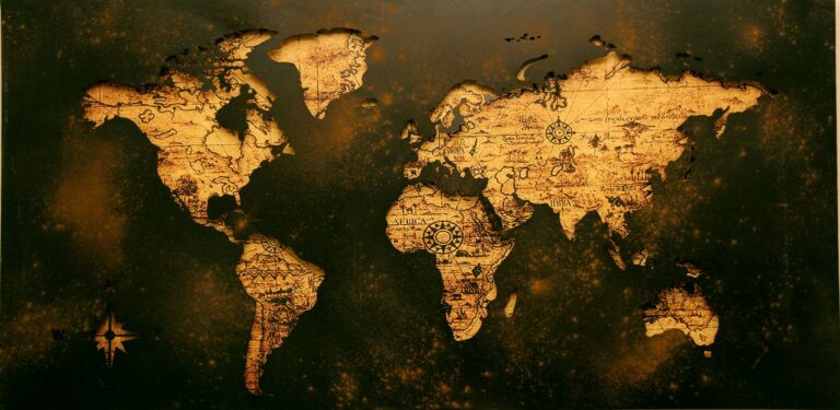
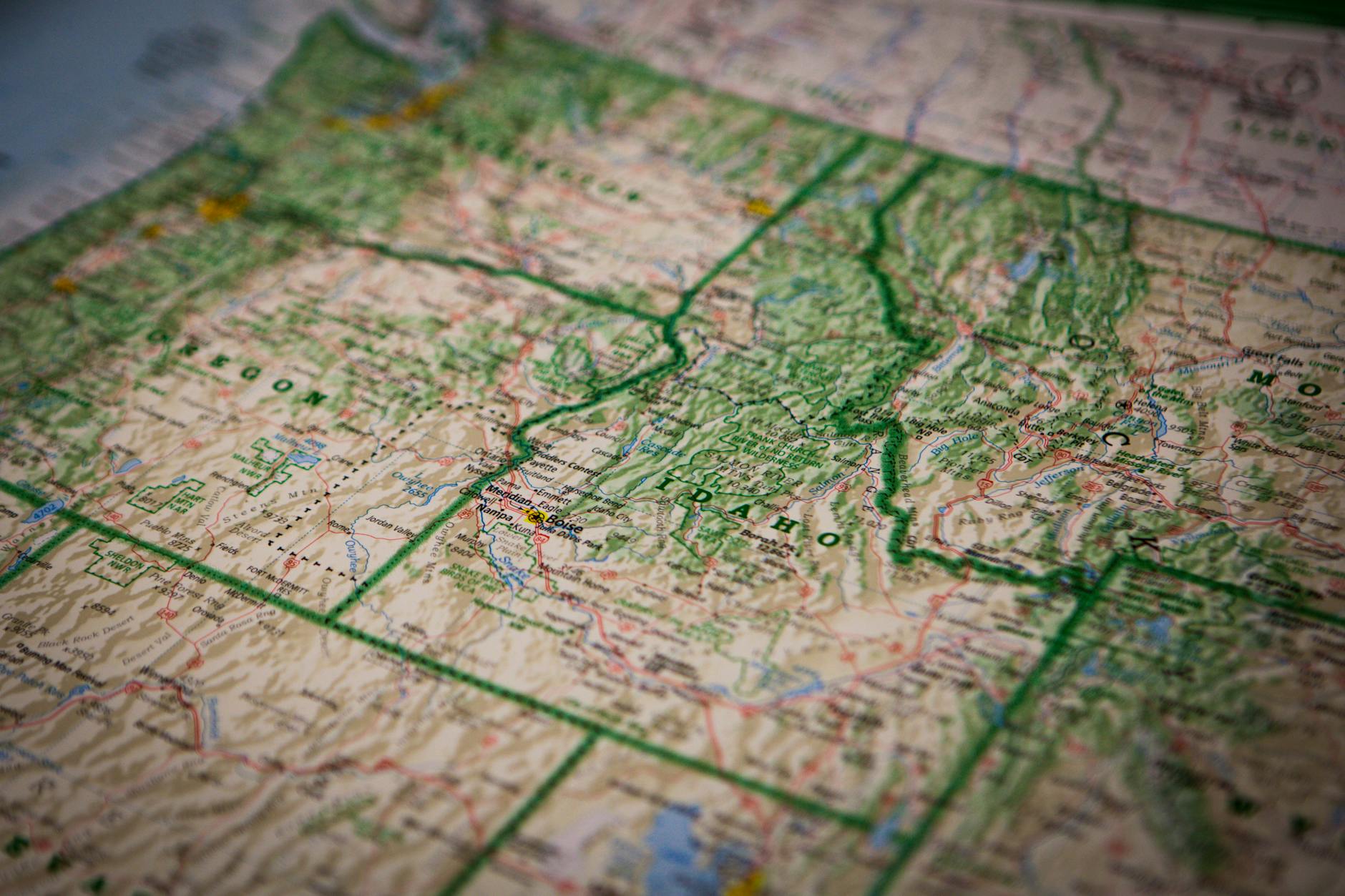
When most people think of a map, they envision a General Reference Map. These geographic maps are designed to provide a broad overview of a geographic area. They incorporate a variety of information to serve multiple purposes.
Key Features:
- General reference maps typically show natural features like mountains, rivers, and forests. They also include human-made features such as roads, cities, and boundaries.
- They do not focus on a specific theme or topic. Instead, they present an integrated view of an area to aid in navigation and general understanding.
- Technological Evolution: Reference maps have evolved significantly, transitioning from traditional paper formats to interactive digital versions. These digital maps allow you to zoom in from a global view to specific streets instantly.
Examples:
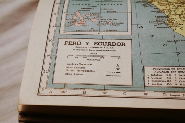
- Another example is the maps found in world atlases, which provide detailed views of countries and continents.
Uses:
- These maps are often used for educational purposes, travel planning, and gaining a general understanding of geographic regions.
- Practical Tip: Even with modern advancements, the ability to read a basic reference map remains essential. This skill is especially important when technology fails, such as when your phone’s battery dies.

2. Topographic Maps
Topographic maps are a specialized type of map that emphasizes the physical features of the Earth’s surface, particularly its elevation and terrain.
Key Features:
- Topographic maps are distinguished by their use of contour lines to represent elevation. These lines allow you to visualize the terrain’s shape, such as hills, valleys, and plateaus.
- In addition to elevation, these maps often show other physical features like rivers, lakes, and roads, making them useful for both navigation and understanding the landscape.
Examples:
- One well-known example is the topographic maps produced by the Indonesian Army’s Topographic Directorate and AMS (Army Map Service).
- These maps are often used by hikers, engineers, and military personnel.
Uses:
- Topographic maps are invaluable for outdoor activities such as hiking, camping, and land surveying. Urban planners also use them in assessing land for construction projects.
- Pro Tip: Understanding that the numbers on contour lines always point uphill is a crucial tip for accurately reading topographic maps, especially when determining elevation changes.

3. Thematic Maps
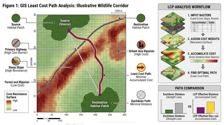
Unlike General Reference and Topographic Maps, Thematic Maps focus on specific themes or topics. They highlight particular aspects of an area based on the intended map purpose, making them one of the most powerful geospatial data visualization tools available.
Key Features:
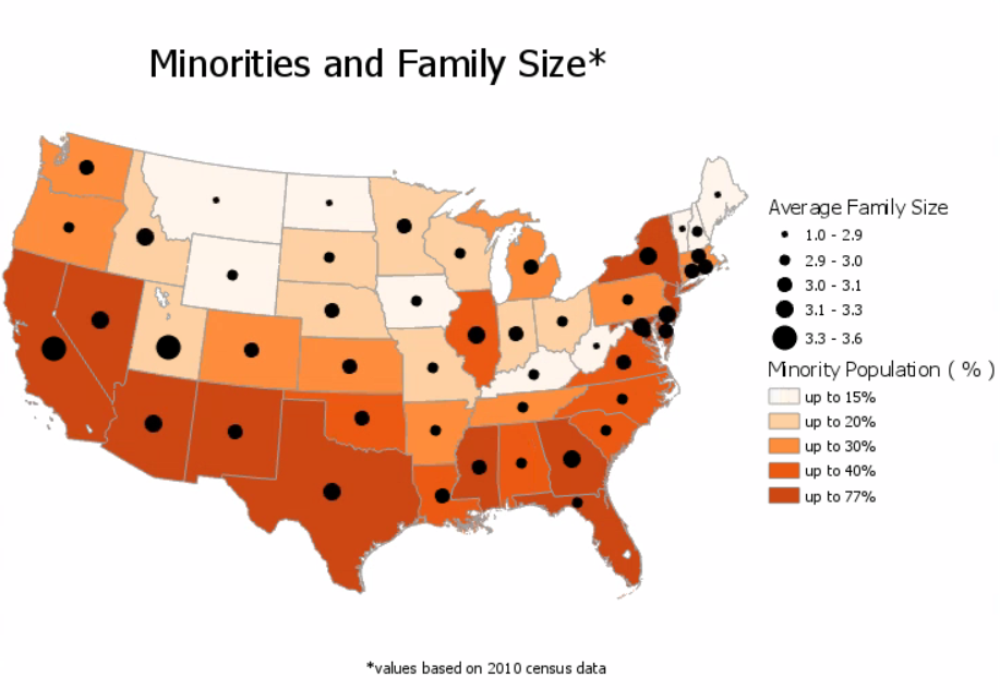
- Thematic maps emphasize one or more pieces of information related to a specific theme, such as population density, climate, economic activities, or vegetation.
- These maps often simplify or omit unrelated details to keep the focus on the theme. This approach makes the map easier to interpret in the context of the specific data it presents.
Examples:
- A common example of a thematic map is one that shows the distribution of population across a country. This type of map highlights urban areas with high density and rural regions with lower populations.
- Another example could be a climate map showing different climate zones within a country or continent.
Uses:
- Thematic maps are widely used in fields such as geography, sociology, and environmental science to illustrate patterns and trends related to specific phenomena.
- Policymakers and planners also find thematic maps useful for making informed decisions based on geographic data.
- Real-World Application: Thematic maps are particularly effective in urban planning for understanding population distribution and resource allocation. They are also crucial in environmental studies for tracking climate changes and managing natural resources.
- Ethical Considerations: It is vital to create thematic maps ethically and accurately. Misrepresenting data on these maps could lead to incorrect conclusions and poor decision-making.
Navigation Charts, also referred to as “charts,” are specialized maps used for navigation—whether by land, sea, or air.
Key Features:
- Navigation charts are designed to provide detailed information necessary for safely navigating from one point to another. They include information about coastlines, water depths, obstructions, and landmarks for sea navigation. For aviation, they provide details on airways, airports, and airspaces.
- These charts require specialized knowledge to read accurately. They often include complex symbols, GPS coordinates, and navigation aids.
- Projection Challenges: Navigational charts handle the representation of a round Earth on a flat surface through various map projection types. These projections are tailored to specific needs, such as polar or equatorial regions.
Examples:
- For land navigation, topographic maps often serve as the primary tool, providing the necessary detail on terrain and roads.
- In maritime navigation, nautical charts are essential. They offer details about the seabed, tidal information, and safe passages.
- In aviation, aeronautical charts are used to show airspace boundaries, navigational aids, and airports.
Uses:
- Navigation charts are critical for pilots, mariners, and drivers who need precise and up-to-date information to navigate safely. They are also used by the military and commercial transportation industries.
- Importance of Regular Updates: Regular updates to navigational charts are crucial. Natural and man-made features can change over time, and outdated charts can lead to navigational errors.
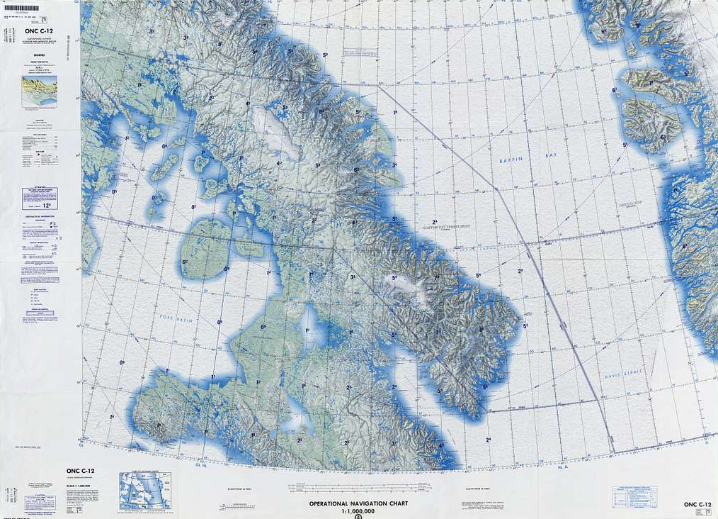
Covers Greenland (Denmark) in Lambert Conformal Conic Projection. Example of a navigational chart or navigational map types. Sources: here.
5. Cadastral Maps
Cadastral Maps are highly detailed maps that focus on specific properties and land parcels. They are primarily used for legal purposes and land ownership, making them a distinct map type in GIS and surveying workflows.
Key Features:
- Cadastral maps show boundaries and ownership details of land parcels. They may include additional information such as survey district names, unique parcel identifiers, and land use or zoning information.
- These maps require highly accurate surveying techniques. Precision is critical when depicting property boundaries.
Examples:
- A common example of a cadastral map is a property map used in land registration offices. These maps show the boundaries of individual land parcels and their ownership details.
- Another example could be a cadastral map used in urban planning to manage land development and zoning.
Uses:
- Cadastral maps are essential tools for government agencies, surveyors, and legal professionals involved in land ownership, property disputes, and urban planning.
- They are also crucial for developers and real estate professionals. Cadastral maps help assess the potential and limitations of land for development.
- Historical Significance: Cadastral maps were among the earliest known maps. Ancient civilizations created them to depict property boundaries, emphasizing their longstanding importance in human society.
Another Way to Classify Map Types
Maps are categorized based on several key factors, including:
- Content
- Scale
- Form or Media
- State of Objects
- Data Sources
- Purpose and Content
Types of Maps Based on Content
General Maps: General maps, also known as summary maps, depict all features within a specific area. These features include roads, mountains, lakes, and more. Such maps provide a geographical base and serve functional purposes. For instance, a city map is considered a “general-purpose” map, aimed at offering comprehensive reference data.
One of the most detailed types of general-purpose maps is the topographic map. Topographic maps show the fundamental locations of terrain features on the Earth’s surface. These features include transportation networks, hydrography, cultural elements, and elevation.
Special Maps: Special maps, or thematic maps, focus on the distribution of a particular theme, such as population density or rainfall patterns. These maps act as powerful data visualization tools, quickly conveying complex information. By effectively visualizing intricate data, thematic maps allow readers to interpret the information more efficiently than they would from tables or charts.
Types of Maps Based on Form
Maps can also be classified according to their physical mapping format or the medium on which they are represented. The main types include:
- Flat Maps
- Relief Maps
- Digital Maps
Flat Maps: Flat maps are traditional maps made on a flat surface, such as paper, canvas, or cloth. This is the most common form of maps that people encounter.
Relief Maps: Relief maps are designed to represent terrain in three dimensions. These maps often use materials like cement and sand to visually convey the topography of an area. They display elevations and depressions, making the landscape easier to understand.
Digital Maps: Digital maps are created and displayed using computer technology. Initially, such maps could only be accessed via specialized software. However, with technological advancements, these maps can now be viewed on almost any device, including computers, smartphones, and tablets. Common examples include Google Maps, Bing Maps, and Apple Maps.
Types of Maps Based on Scale
Map scale is one of the most practical ways to classify maps, as it directly determines the level of detail you’ll see.
The main types are:
- Small-scale Maps
- Medium-scale Maps
- Large-scale Maps
- Very Large-scale Maps (Cadastral Maps)
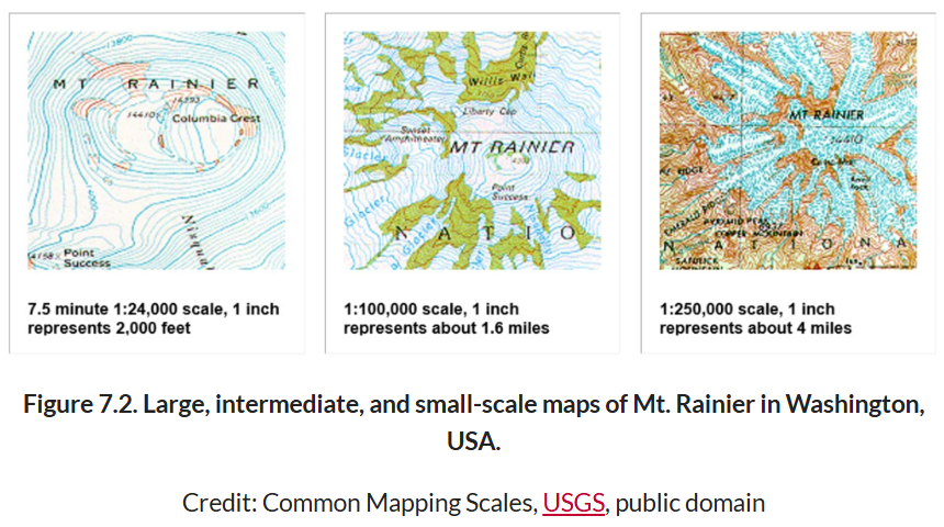
Small-scale Maps: Small-scale maps are designed to represent large areas, such as a map of a country or continent. These maps typically use a scale ranging from 1:500,000 to 1:1,000,000.
Medium-scale Maps: Medium-scale maps cover relatively large areas, such as provinces or regions. These maps generally have scales ranging from 1:250,000 to 1:500,000.
Large-scale Maps: Large-scale maps depict smaller areas in greater detail, such as cities or districts. These maps often use scales ranging from 1:5,000 to 1:250,000.
Very Large-scale Maps: Also known as cadastral maps, these maps are used for detailed representations, such as land parcel mapping for legal purposes. The scale typically ranges from 1:100 to 1:5,000.
Types of Maps Based on Object State
Another way to classify maps is based on the state of the objects they depict:
- Static Maps
- Dynamic (Interactive) Maps
Static Maps: Static maps represent a stable, unchanging view of the Earth’s surface. These maps can be provided in digital formats (such as PNG, JPG, PDF) or printed on paper. They are designed for specific purposes and can be reused multiple times.
Dynamic (Interactive) Maps: Dynamic maps allow users to interact with the map and display objects based on user preferences, provided the application supports it. Over the last decade, these maps have become increasingly popular, starting with platforms like MapQuest and Google Maps. They now extend to numerous web and mobile applications.
Types of Maps Based on Data Source
Based on the origin of the data used to create them, maps can be divided into:
- Base Maps
- Derived Maps
Base Maps: Base maps, or foundational maps, are directly produced from field surveys or other primary data sources, such as satellite images or aerial photographs. These maps serve as the groundwork for creating thematic maps.
Derived Maps: Derived maps are created using information from existing maps. These maps often result from spatial analysis using GIS techniques, such as overlaying multiple maps or performing remote sensing. The process produces new maps that combine various data layers.
Purpose and Content
Maps can also be classified based on their specific purpose and the type of content they present. Understanding this map classification helps you quickly identify which map fits your workflow.
Here are some examples:
Historical Maps:
- Explanation: Historical maps depict geographic areas as they were at a specific point in history. These maps are valuable for understanding historical events, changes in political boundaries, and the development of civilizations. They often provide insights into colonial periods and other significant eras in history.
- Example: A map showing the territorial boundaries of the Roman Empire at its peak.
Political Maps:
- Explanation: Political maps focus on governmental boundaries, such as countries, states, and cities. They are designed to show political units and are often used for educational and reference purposes.
- Example: A map of the United States highlighting each state and its capital.
Weather Maps:
- Explanation: Weather maps display meteorological conditions over a specific area at a given time. They are used for weather forecasting and understanding climate patterns.
- Example: A map showing a weather forecast with symbols indicating precipitation, temperature, and wind direction.
Economic Maps:
- Explanation: Economic maps highlight economic activities or resources in a particular region. These maps can show information like the distribution of industries, agricultural production, or natural resources.
- Example: A map displaying the major oil-producing regions in the Middle East.
Geological Maps:
- Explanation: Geological maps illustrate the types and distribution of rocks and minerals beneath the Earth’s surface. These maps are essential for geologists and are often used in geological exploration and environmental studies.
- Example: A map showing different rock formations and fault lines in a region.
Population Maps:
- Explanation: Population maps show the distribution of people across a specific area. These maps often use color-coding or shading to represent population density.
- Example: A map showing population density across different regions of India.
Conclusion
In conclusion, the diverse world of maps offers a wide range of map types, each designed to serve a specific purpose. From topographic to thematic, navigational to historical, and static vs dynamic maps to highly specialized cadastral maps, understanding these different types of maps and their uses can enhance your navigation skills and deepen your knowledge of the world around you.
Whether you’re a seasoned cartographer or just beginning to explore the fascinating world of cartography basics, this guide has provided you with a comprehensive overview of the various types available.
Remember, the key to effectively using maps lies in choosing the right type for your needs. As you continue to explore the ever-evolving world of cartography, let this guide be your starting point for discovering the incredible utility and beauty that maps bring to your understanding of the world.
Frequently Asked Questions (FAQ)
What are the main types of maps in geography?
The five primary map types recognized by ICSM are General Reference Maps, Topographic Maps, Thematic Maps, Navigation Charts, and Cadastral Maps. Each serves a distinct purpose, from broad geographic overviews to highly detailed land parcel records. Beyond these five, maps can also be classified by scale, form, data source, and object state.
What is the difference between a general reference map and a thematic map?
A general reference map shows a wide range of features — roads, rivers, cities, and terrain — without focusing on any single topic. A thematic map, on the other hand, strips away unrelated detail and zooms in on one specific theme, such as population density, vegetation, or climate zones. If you need a broad overview, reach for a reference map; if you need to analyze a pattern, a thematic map is your tool.
Which type of map is best for hiking or outdoor activities?
Topographic maps are the go-to choice for hiking, camping, and land surveying. They use contour lines to show elevation changes, which helps you understand the steepness of terrain before you’re standing on it. Many GIS platforms like QGIS also allow you to generate and customize topographic map outputs from digital elevation models.
What is the difference between a static map and a dynamic map?
A static map presents a fixed, unchanging view of geographic information — think a printed trail map or a PNG export from GIS software. A dynamic map lets you interact with the data in real time, zooming, filtering, and toggling layers as needed. Platforms like Google Maps and web-based GIS applications are common examples of dynamic mapping.
How many types of maps are there?
There is no single definitive count, because maps can be classified in multiple overlapping ways — by content, scale, form, purpose, or data source. The ICSM identifies five primary types, but when you factor in sub-categories like political maps, geological maps, weather maps, and population maps, the list grows considerably. In practice, the right question is not “how many” but “which type fits my specific need?”
What types of maps are commonly used in GIS?
GIS workflows rely on a wide range of map types depending on the task. Thematic maps are common for data analysis and visualization. Topographic maps serve as base layers for terrain analysis. Cadastral maps support land management and property workflows. Base maps and derived maps produced through remote sensing and spatial analysis are also central to most GIS projects.