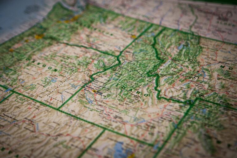
Did you know that the representation of terrain on a map can significantly impact how effectively you understand the landscape?
A topographic map accurately shows the Earth’s surface features, including elevation, natural landmarks, and human-made structures, using contour lines to represent height variations.
Topographic maps are crucial tools for accurately depicting both natural and man-made features, helping you grasp the complexities of the Earth’s surface. These maps are a key part of cartography and are often used in geospatial analysis to provide detailed information for various applications.
In this article, you’ll explore what a topographic map is, why it matters, and how understanding these maps can enhance your ability to navigate and plan effectively.
Contents
- 1 What Is a Topographic Map?
- 2 What Information Is Included in a Topographic Map?
- 3 How to Read a Topographic Map
- 4 Benefits of a Topographic Map
- 5 Contour Lines on a Topographic Map: A Closer Look
- 6 How Topographic Maps Are Made
- 7 Example of Topographic Maps
- 8 Topographic Map Use and Application
- 9 Where to Get Topographic Maps
- 10 Conclusion
What Is a Topographic Map?
Topographic maps display the basic location of terrain features on the Earth’s surface, including transportation, hydrography, cultural features, and elevation.
According to Kers (1977), a topographic map is “a map that presents a depiction of the Earth’s surface as accurately as possible, within the limits of its scale, and shows both natural and cultural elements.” It accurately represents the position of these elements, including their location, situation, and elevation.
Topographic maps are considered general-purpose maps, meaning they provide a geographical basis and have a functional rationale.
They are often referred to as “geographical dictionaries” because they emphasize geographic positions and locations, as well as planimetric accuracy. The cartographic representation in these maps is crucial for various fields, including urban planning and environmental mapping.
In addition to being valuable for outdoor enthusiasts, topographic maps are essential tools in various fields, including construction, environmental studies, and emergency services.
Since 1879, the U.S. Geological Survey (USGS) has produced thousands of topographic maps that cover the entire United States, making them a crucial part of the nation’s cartographic history.

What Information Is Included in a Topographic Map?
Topographic maps offer comprehensive details about the landscape. Here’s what you can find:
- Relief: Mountains, valleys, slopes, and basins are defined by contour lines. These lines help you visualize the terrain’s elevation. Think of contour lines as Mother Nature’s connect-the-dots puzzle
- Hydrography: Features like lakes, rivers, streams, marshes, and waterfalls are crucial for determining water sources and potential obstacles. These natural features provide context about the environment and can help in understanding the local ecosystem.
- Vegetation: Forested areas are marked, indicating dense growth that could impact travel routes.
- Transportation: Highways, footpaths, railways, bridges, airports, and ports are clearly marked. These routes show how accessible different areas are.
- Cultural Features: Buildings, urban developments, power transmission lines, pipelines, and towers help identify human-made structures. These features allow you to understand human settlements and infrastructure.
- Administrative Boundaries: International, provincial, and territorial boundaries are marked for geopolitical awareness.
- Toponymy: Place names, water feature names, landform names, and boundary names are essential for orientation and communication. These maps also often include map legends and map keys, which help you understand the symbol usage and color classification.
How to Read a Topographic Map
Learning how to read a topographic map is crucial for outdoor activities and professional tasks. Based on my experience, here’s how you can get started:
- Understand the context, legend, and scale:
- The National Grid Referencing System is often used to divide the map into squares for easier reference and location finding.
- The legend explains map symbols (e.g., roads, rivers).
- The scale shows the map’s coverage. For example, 1:50,000 means 1 unit on the map equals 50,000 units in reality.
- Intermediate Scale, Small Area Plans, Large Regional Maps: Topographic maps come in different scales, from small area plans for detailed local mapping to large regional maps for broader coverage.
- Identify Contour Lines:
- Contour lines connect points of equal elevation.
- Close lines indicate steep terrain; wide spacing suggests gentle slopes. For instance, if you see multiple contour lines close together, it means the terrain is steep and rocky. If the lines are far apart, the terrain is flat or gently sloping.
- Interpret Elevation:
- Numbers on contour lines show elevation above sea level.
- Concentric circles represent hills. Higher elevation is shown at the center, while tick-marked lines indicate depressions. A bunch of concentric circles likely indicates a hill or mountain peak. The smallest circle is usually the summit.
- Recognize Symbols and Colors:
- Green: Forests, Blue: Water bodies, Brown: Contour lines.
- Typically, man-made features are shown in black or red.
- Understand Coordinate System and Map Projection:
- Coordinate systems help pinpoint exact locations on the map using latitude and longitude or a grid system. Understanding the coordinate system is crucial for precise navigation.
- Map projection refers to how the three-dimensional Earth is represented on a two-dimensional map. Common projections in topographic maps include the Mercator and Universal Transverse Mercator (UTM).
- Geodetic datums provide a reference framework for the coordinate system, ensuring that all map data aligns accurately with the Earth’s surface. The most widely used datum is WGS 84 (World Geodetic System 1984).
- Check Map Orientation:
- Most maps are oriented to true north. Use the north arrow for alignment.
- Note magnetic declination for accurate compass use. Using a compass and the map’s compass rose can be a game-changer when you’re in the field.
- Practice with Real Maps:
- Start with familiar areas, like local parks, and match contour lines with actual terrain.
- Progress to more complex maps as you become comfortable.
- Field Use Tips:
- Orient your map to the landscape.
- Use a compass to maintain direction.
- Track progress by identifying landmarks on both the map and ground. Mastering these basics will enhance your ability to navigate terrain confidently.
Benefits of a Topographic Map
Topographic maps are created for general purposes and have a wide range of applications, especially for those who know how to read a topographic map. They provide detailed information about topographic features and natural and artificial structures.
- They serve as a crucial tool in land navigation.
- Topographic maps are essential for engineers and urban planners. They provide detailed information about landforms, which is crucial for designing infrastructure projects like roads, buildings, and bridges. These maps also support terrain analysis and landform identification, which are vital for various engineering and planning tasks.

Contour Lines on a Topographic Map: A Closer Look
Understanding contour lines is essential for anyone looking to learn how to read a topographic map. These lines connect points of equal elevation, forming a continuous loop that outlines the terrain’s shape. By examining the contour lines’ spacing and orientation, you can determine whether the landscape is flat, rolling, or mountainous.
Close lines indicate steep terrain, while wide lines suggest flatter land. These details can help you determine where to rest and where to proceed with caution.
For a more in-depth understanding of contour lines, check out this article:
How Topographic Maps Are Made
Topographic maps are produced through a combination of topographical surveys, geospatial data collection, and cartographic representation. Here’s an overview of the process:
- Topographical Survey: Surveying techniques are used to gather data about the Earth’s surface. These surveys often involve measuring angles and distances using tools like theodolites and GPS equipment.
- Geospatial Data: The data collected during surveys is combined with geospatial data from sources like aerial photography, LiDAR, and satellite imagery. This data provides a comprehensive view of the landscape.
- Cartographic Representation: The collected data is then translated into a map using cartographic techniques. This involves creating contour lines, symbols, and other map elements that accurately represent the terrain.
- Standard Geodetic Framework: Maps are aligned with a standard geodetic framework, such as WGS 84, to ensure consistency and accuracy across different maps.
- National Grid System: Many topographic maps are overlaid with a national grid system, which helps users find specific locations on the map.
- Map Production: The final map is produced using cartographic tools and software. The process may involve both manual and digital techniques, depending on the complexity and scale of the map.
- Cartographic Standards and Conventions: Cartographic standards and map conventions ensure that the map is easy to read and understand. This includes the use of standard symbols, colors, and text.
- Map Analysis and Interpretation: Once the map is produced, it undergoes map analysis and interpretation to verify its accuracy and usefulness. This step ensures that the map meets the needs of its intended users.
Example of Topographic Maps
Topographic maps come in various formats and scales, providing detailed information for different types of terrain and uses.
Here are some examples:
- U.S. Geological Survey (USGS) Maps: Covering the entire United States, these maps are available at various scales and are crucial for outdoor activities, urban planning, and environmental studies.
- National Park Service Maps: These maps offer detailed topographic information for national parks, making them ideal for hikers and nature enthusiasts.
- Military Topographic Maps: Designed for operational planning, these maps include additional features like military grid references. They are used by armed forces worldwide.
- Digital Topographic Maps: Modern topographic maps are now available in digital formats. They allow for easy access and manipulation through apps and software. These can be zoomed in and out, offering users detailed views of specific areas.
These examples highlight the diversity of topographic maps and their applications. They showcase how these maps serve various needs, from recreational use to professional and military applications.
Check out another type of map:
Topographic Map Use and Application
Topographic maps are essential tools used across various applications, both for outdoor activities and professional planning:
- Navigation Tools: Topographic maps are invaluable for activities such as trail running, hiking, and orienteering. They help users assess elevation changes, plan routes, and navigate complex terrains safely and efficiently.
- Planning Tools: In urban and environmental planning, topographic maps serve as critical resources. They support urban planning, environmental mapping, urban mapping, and emergency response planning, offering detailed insights into land use and infrastructure.
- Terrain Analysis: Topographic maps are crucial for terrain analysis, helping to identify and understand key landforms such as saddles, peaks, valleys, and ridges. This understanding is vital for accurate landform identification and planning in both natural and built environments.
Topographic maps play a vital role in a wide range of activities, from navigating rugged landscapes to planning large-scale urban projects. Their versatility and detailed representation of the terrain make them indispensable tools for both recreational and professional use.
Where to Get Topographic Maps
Obtaining topographic maps has never been easier, thanks to various sources that offer both physical and digital versions. Based on my experience, here’s where you can find them:
- U.S. Geological Survey (USGS) Website: The USGS offers a vast collection of topographic maps covering the entire United States. You can download these maps for free or order printed versions.
- National Park Service (NPS): If you’re planning a trip to a national park, the NPS provides detailed topographic maps specific to each park. These maps are often available at visitor centers or can be downloaded online.
- Local and State Government Websites: Many state and local government websites offer topographic maps for their regions. These can be useful for more localized planning and outdoor activities.
- Mapping Software and Apps: Digital maps are available through various apps and software platforms, such as Google Earth, AllTrails, and Gaia GPS. These tools often allow you to customize maps and download them for offline use.
- Specialty Outdoor Retailers: Stores that specialize in outdoor gear often carry physical topographic maps, particularly those that cover popular hiking and camping areas.
Whether you prefer a physical map or a digital version, these sources provide a variety of options to suit your needs.
Conclusion
Through this article, you’ve explored what a topographic map is, including its characteristics, functions, and several examples of topographic maps. You’ve also learned the importance of understanding how to read these maps—a valuable skill for outdoor enthusiasts, navigators, and planners alike.
Topographic maps are essential in many fields, from construction to environmental studies. Whether you’re a hiker, an engineer, or simply someone curious about the world around you, learning to use a topographic map can be incredibly empowering.
If you have any questions or experiences with topographic maps, share them in the comments below.
I hope this article has been helpful in your journey to mastering topographic maps.