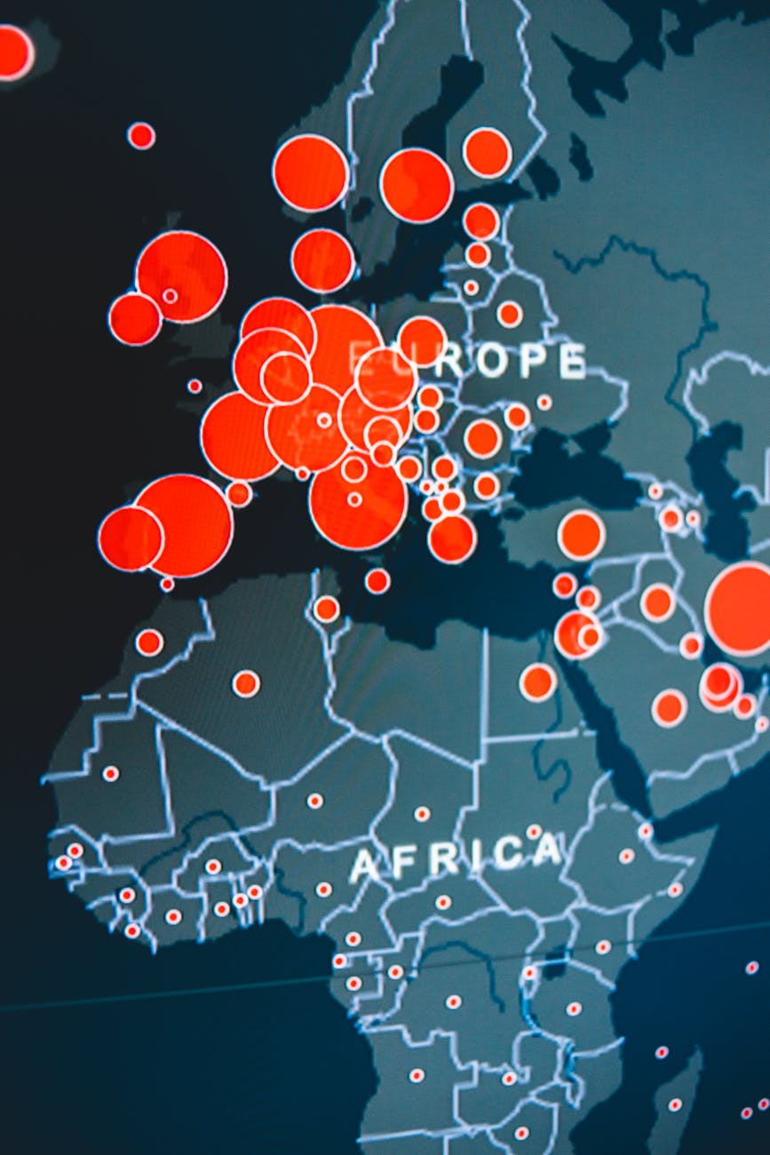
In 1953, mapping the coastline of Great Britain required surveyors, theodolites, and years of field work. The result was a measurement.
In 2023, the same coastline can be re-mapped in days using satellite imagery, processed automatically, and compared against the 1953 baseline to quantify exactly how much it has changed.
Same coastline. Completely different infrastructure behind the measurement.
That infrastructure is geospatial technology — and understanding what it is, what it contains, and how its pieces connect is foundational to working intelligently with any spatial data.
Contents
- 1 What Is Geospatial Technology?
- 2 What Technologies Make Up the Geospatial Stack?
- 3 How Do These Technologies Work Together?
- 4 What Are the Emerging Geospatial Technologies?
- 5 How Is Geospatial Technology Different From GIS?
- 6 How Do You Get Started With Geospatial Technology?
- 6.1 Are you a data analyst comfortable with Python or R?
- 6.2 Do you use Power BI or Tableau?
- 6.3 Are you a journalist or designer who creates infographics?
- 6.4 Are you a tech enthusiast who enjoys exploring new platforms?
- 6.5 Do you hike, run, or spend time outdoors?
- 6.6 Not sure where to start at all?
- 6.7 Ready to go all in on GIS?
- 7 Wrap Up
- 8 FAQ
- 8.1 What is geospatial technology in simple terms?
- 8.2 What is the difference between GIS and geospatial technology?
- 8.3 What are the main types of geospatial technology?
- 8.4 What is GPS and how does it relate to geospatial technology?
- 8.5 What is a spatial database and why is it needed?
- 8.6 What are the emerging trends in geospatial technology?
- 9 Ready to Go Deeper?
What Is Geospatial Technology?
Geospatial technology is the collection of tools, systems, and platforms used to capture, store, process, analyze, and communicate information about Earth’s surface.
It is the technology layer of the geospatial field — the infrastructure that makes modern spatial analysis possible and the machinery that turns raw location data into maps, models, and decisions.
Think of it this way. The geospatial field has three pillars: geospatial data, geospatial technology, and geospatial analysis.
Data is the raw material (coordinates, imagery, boundaries, attributes. Analysis is the process) extracting patterns, answering questions, and building geospatial models.
Geospatial technology is everything in between: the instruments that collect the data, the systems that store and manage it, the software that processes and analyzes it, and the platforms that deliver the results to people who need them.
One important distinction to establish early: geospatial technology is not the same as GIS. Geographic Information Systems are one component of the geospatial technology stack.
But geospatial technology encompasses the entire ecosystem, from the satellites collecting imagery in orbit to the web APIs delivering map tiles to a browser. GIS is the brain. Geospatial technology is the entire nervous system.
What Technologies Make Up the Geospatial Stack?
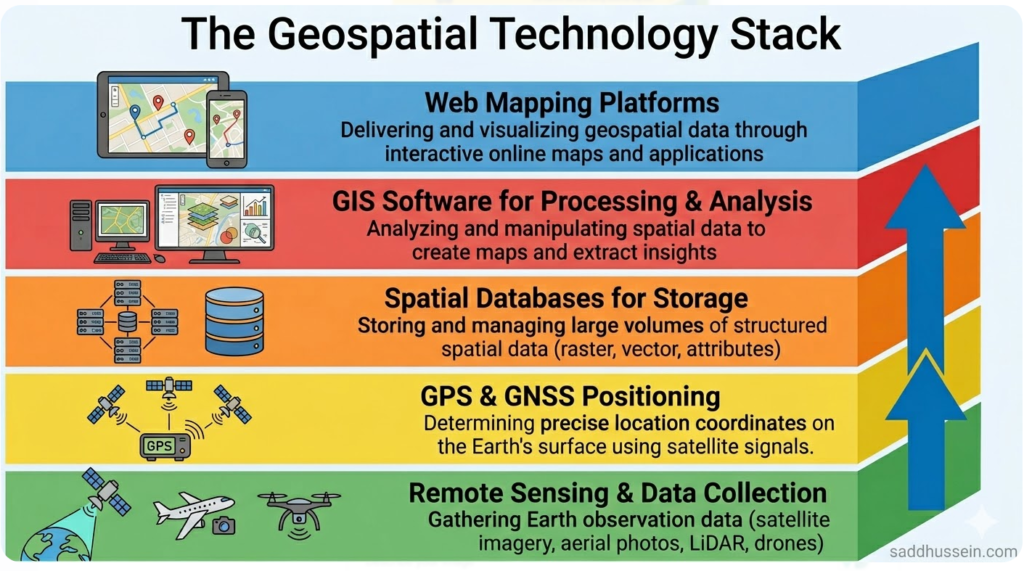
The geospatial technology stack has five core components.
Each one performs a distinct function, and each one depends on the others to be fully useful. Here is what each component does and where it fits in the overall system.
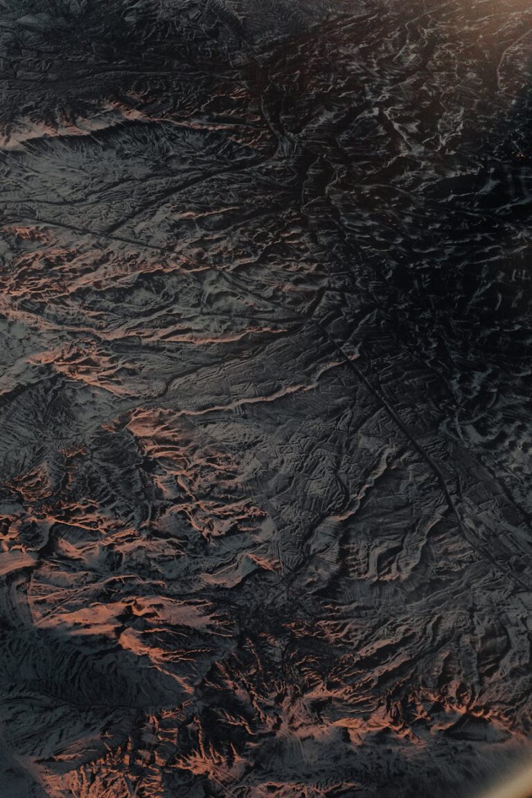
Remote sensing provides the Earth observation data — satellite imagery, aerial photography, LiDAR point clouds — that gives the stack its view of the world.
GPS and GNSS provide the precise positioning that anchors everything to real-world coordinates.
GIS provides the analytical environment where data is processed, queried, and modeled.
Spatial databases provide the storage and retrieval infrastructure that makes large-scale geospatial data management possible.
Web mapping platforms provide the delivery layer that puts geospatial information in front of the people and systems that need it.
Together, these five components form a complete pipeline from data collection to decision support. Understanding each one individually is the first step to understanding how they work as a system.
Remote Sensing — The Eyes of the Stack
Remote sensing is the technology that observes the Earth’s surface from a distance, using sensors mounted on satellites, aircraft, or drones to detect electromagnetic energy reflected or emitted by the surface.
It is the primary source of large-area, time-series geospatial data, the foundation on which many other geospatial workflows are built.
Passive remote sensing systems like Landsat and Sentinel-2 detect reflected solar radiation across multiple wavelength bands simultaneously, producing multispectral imagery that reveals land cover, vegetation health, soil moisture, and surface temperature.
Active systems like Sentinel-1 SAR emit their own microwave energy and measure the return signal, enabling data collection at night and through cloud cover.
LiDAR systems emit laser pulses that return precise distance measurements, producing high-resolution three-dimensional point clouds used for elevation modeling, forest structure analysis, and urban mapping.
Remote sensing is what gives geospatial technology its planetary reach.
Without it, the stack would be limited to data collected on the ground. It is valuable, but orders of magnitude smaller in spatial and temporal coverage.
GPS and GNSS — The Positioning Layer
GPS (the Global Positioning System) is the technology most people associate with geospatial work, and for good reason.
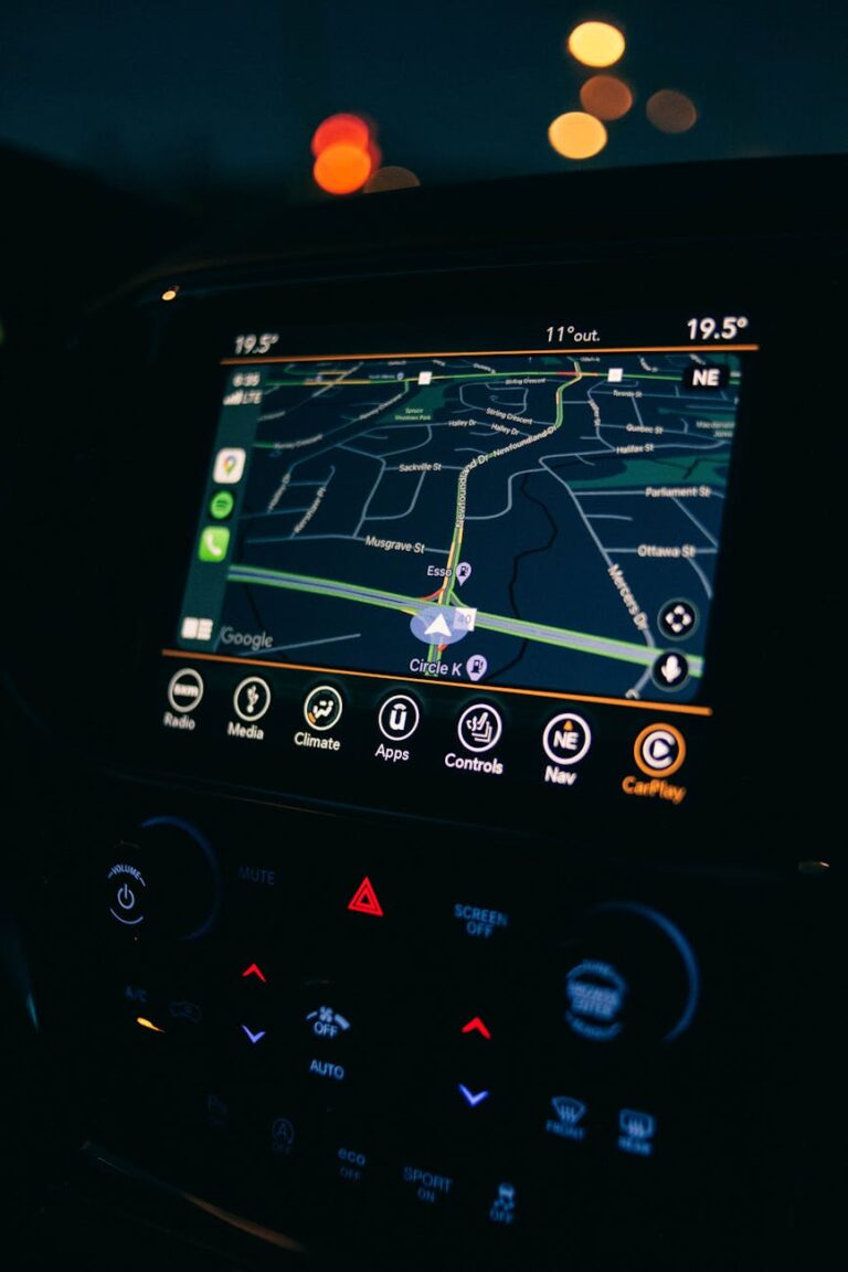
It is the mechanism that assigns precise real-world coordinates to everything in the stack, from field-collected survey points to satellite image pixels to the location dot on your phone screen.
GPS is actually one constellation within a broader category called GNSS (Global Navigation Satellite Systems).
The United States operates GPS. Russia operates GLONASS. The European Union operates Galileo. China operates BeiDou. Modern GNSS receivers can access signals from multiple constellations simultaneously, improving both accuracy and reliability.
The underlying principle is trilateration.
A GNSS receiver measures its distance from at least four satellites by calculating how long their signals took to arrive. With four distance measurements and the known positions of those satellites, the receiver can calculate its precise three-dimensional position on Earth’s surface. Standard consumer GNSS accuracy is typically within a few meters. Survey-grade receivers using differential correction techniques achieve centimeter-level accuracy.
GNSS is what makes field data collection spatially meaningful.
When a field ecologist records a species observation, a surveyor marks a property boundary, or an engineer stakes an infrastructure alignment, GNSS is the technology that gives those observations precise geographic coordinates and makes them compatible with every other layer in the GI
From my experience in field survey workflows, understanding your GNSS equipment’s accuracy characteristics is one of the most consistently overlooked factors in data quality management.
GIS — The Analysis Layer
GIS software is the analytical environment where geospatial data is imported, managed, processed, queried, visualized, and modeled.
It is the component most GIS professionals interact with most directly and the one that gives the stack its decision-support capability.
GIS software comes in three broad categories.
Desktop GIS platforms like QGIS (free and open-source) and Esri’s ArcGIS Pro provide full-featured analytical environments for working with vector and raster data, running spatial queries, building models, and producing cartographic outputs.
Cloud GIS platforms like ArcGIS Online and Google Earth Engine bring computation to the data rather than the data to the analyst, enabling large-scale processing without local infrastructure.
Web GIS frameworks like Leaflet, Mapbox GL, and OpenLayers support custom map application development for specific use cases.
What makes GIS software distinct from a standard database or visualization tool is its understanding of spatial relationships.
A GIS knows that a point is inside a polygon, that two lines intersect, that a set of features falls within a given distance of a target. It can overlay layers, calculate areas and distances, trace network routes, and run spatial statistics, operations that require both geographic coordinate systems and spatial logic that general-purpose software doesn’t natively support.
As I’ve found working across multiple GIS platforms, the choice between desktop, cloud, and web GIS depends almost entirely on data volume, collaboration requirements, and the technical environment of the organization.
For most individual analysts starting out, QGIS provides everything needed to build a strong foundational skillset at zero cost.
Spatial Databases — The Storage Layer
As geospatial datasets grow in size and complexity, storing them in flat files like shapefiles or GeoTIFFs becomes increasingly impractical.
Spatial databases solve this problem by extending standard relational database architecture with geometry data types, spatial indexes, and spatial query functions making it possible to store, retrieve, and query large geospatial datasets efficiently.
The most widely used open-source spatial database extension is PostGIS, which adds geospatial capability to PostgreSQL.
With PostGIS, you can store millions of geographic features and run spatial queries: find all parcels within 500 meters of a flood zone, calculate the area of each land cover class, identify road segments that intersect a proposed development boundary, directly in the database, without loading data into a GIS desktop application first.
Spatial indexing is what makes this fast.
Standard database indexes work well for attribute queries. Spatial indexes organize geometry data so that the database can quickly identify which features fall within a given spatial extent without scanning every record in the table.
For large datasets covering national or continental extents, spatial indexing is the difference between a query that returns in seconds and one that times out.
For GIS professionals moving beyond single-project analysis into operational systems, production data management, or multi-user environments, spatial databases are not optional infrastructure.
They are the foundation on which scalable geospatial systems are built.
Web Mapping and Location Platforms — The Delivery Layer
Geospatial technology reaches most of its end users not through desktop GIS software but through web maps and location-aware applications.
Web mapping platforms are the delivery layer of the stack, the technology that puts geospatial information in browsers, mobile apps, dashboards, and operational systems used by people who may never open a GIS platform directly.
The core architecture of web mapping relies on map tile services: pre-rendered image or vector tiles organized into a pyramid of zoom levels that a browser or app can request and display efficiently.
Platforms like Mapbox, ArcGIS Online, and Google Maps Platform provide both tile services and APIs that developers use to build custom location applications on top of managed geospatial infrastructure.
Open-source web mapping libraries like Leaflet and OpenLayers give developers full control over map rendering without platform dependency.
For organizations building public-facing map applications, these libraries combined with open tile sources like OpenStreetMap provide a complete web mapping stack at minimal cost.
Location platforms extend web mapping further into real-time and operational contexts. Fleet tracking systems, real-time disaster monitoring dashboards, precision agriculture platforms, and public transit apps are all built on web mapping and location platform infrastructure.
From my perspective, the growth of the location platform layer has done more to expand the reach of geospatial technology into everyday decision-making than any other development in the past decade.
How Do These Technologies Work Together?
The five components of the geospatial technology stack don’t operate independently. They form an integrated data pipeline, and understanding how data flows through that pipeline helps you diagnose problems, design better workflows, and make smarter technology choices.
Here’s how a complete geospatial workflow moves through the stack.
A field GPS unit collects survey points with precise GNSS coordinates. Those points are uploaded to a spatial database alongside satellite imagery acquired by a remote sensing platform.
A GIS analyst uses desktop or cloud GIS software to process the imagery, run spatial queries against the database, and build an analytical model.
The outputs, such as maps, dashboards, and data products, are published through a web mapping platform to the stakeholders who need them.
Every step depends on the ones before it.
Imagery without accurate GNSS referencing can’t be overlaid with field data. Field data without a spatial database becomes unmanageable at scale. Analysis without GIS software stays descriptive rather than spatial. Results without a web mapping delivery layer reach a tiny fraction of their potential audience.
This is why geospatial technology professionals benefit from understanding the full stack, not just their own layer.
A remote sensing analyst who understands spatial databases makes better decisions about data format and structure.
A GIS analyst who understands web mapping makes better decisions about output formats and coordinate systems.
The stack rewards generalists as much as it rewards specialists.
What Are the Emerging Geospatial Technologies?
The geospatial technology stack is not static. Several emerging technologies are reshaping what the field can do and who can do it.
AI and Machine Learning in Spatial Analysis
Artificial intelligence and machine learning are transforming the geospatial technology stack at multiple levels.
In remote sensing, deep learning models now perform automated feature extraction like detecting buildings, roads, tree canopy, and land cover types in satellite imagery at speeds and scales that manual digitizing could never match.
Object detection models identify specific targets (e.g. vehicles, vessels, construction activity) across large image archives. Predictive spatial models combine remote sensing inputs with ground data to forecast phenomena like crop yield, flood extent, or disease transmission risk.
The integration of AI into GIS software platforms is accelerating.
ArcGIS, QGIS, and Google Earth Engine all now offer machine learning tools accessible without deep coding expertise.
As I’ve observed across the industry, the barrier between remote sensing data collection and analytical output is collapsing as AI automates what previously required weeks of manual processing.
Digital Twins
A digital twin is a virtual replica of a physical environment, built from geospatial data and updated continuously to reflect real-world conditions.
City-scale digital twins integrate building footprints, road networks, utility infrastructure, sensor data, and simulation models into a unified spatial environment that planners, engineers, and emergency managers can use to test scenarios before implementing them in the real world.
Geospatial technology provides the data foundation for digital twins: the satellite imagery, LiDAR surveys, GPS-referenced infrastructure records, and IoT sensor streams that keep the virtual model synchronized with physical reality.
Singapore’s Virtual Singapore and several major European city digital twin programs represent the current leading edge of this technology in operational use.
Drone and UAV Platforms
Unmanned aerial vehicles have democratized high-resolution geospatial data collection in a way that satellite and airborne platforms cannot match for site-level work.
A drone equipped with a multispectral or RGB camera can survey a construction site, agricultural field, or heritage site at centimeter resolution in a fraction of the time and cost of an equivalent airborne survey.
Drone-derived products (orthomosaics, digital surface models, point clouds, multispectral reflectance maps) integrate directly into standard GIS workflows.
For applications requiring sub-meter detail over relatively small areas, drones have become the default data collection platform.
The rapid growth of commercial drone platforms and photogrammetry software has put high-resolution geospatial data collection within reach of individual practitioners and small organizations.
IoT and Real-Time Location Data
The Internet of Things has created a new category of geospatial data: continuous, real-time streams of location-referenced measurements from connected sensors distributed across physical environments.
Environmental sensors monitoring air quality, water level gauges, traffic counters, smart utility meters, and connected vehicles all generate spatial data continuously.
Integrating IoT data streams into geospatial platforms creates real-time situational awareness capabilities that static datasets cannot provide.
Flood early warning systems, urban traffic management platforms, precision irrigation controllers, and supply chain visibility tools all combine IoT sensor data with geospatial infrastructure to support decisions that need to be made in minutes rather than days.

How Is Geospatial Technology Different From GIS?
This distinction is worth restating clearly because the two terms are so frequently conflated even by experienced practitioners.
GIS refers specifically to the software platforms and analytical methods used to manage, analyze, and visualize geospatial data. It is one component of the geospatial technology stack, occupying the analysis and visualization layer.
Geospatial technology is the entire stack. It includes the remote sensing instruments that collect the data, the GNSS systems that position it, the spatial databases that store it, the GIS software that analyzes it, and the web mapping platforms that deliver it. Saying GIS is geospatial technology is like saying Excel is information technology, accurate as far as it goes, but missing most of the picture.
In practice, many job descriptions and industry conversations use “GIS” as shorthand for the broader field.
That’s a reasonable convention in context. But when you’re thinking about the full system, understanding the distinction between GIS and geospatial technology is essential.
How Do You Get Started With Geospatial Technology?
The geospatial technology stack is deep, but the entry points are accessible, and the best starting point is wherever you already are.
You don’t need to learn a new tool from scratch. You need to find the geospatial capability hiding inside the tools you already use.
Here’s how to start from where you are.
Are you a data analyst comfortable with Python or R?
You’re closer than you think.
Python has GeoPandas, Shapely, Rasterio, and Folium, a complete geospatial analysis stack that builds directly on the NumPy and Pandas workflows you already know.
R has the sf and terra packages for spatial data manipulation, plus tmap and leaflet for visualization. Your next data project can have a map layer without changing your working environment at all.
Do you use Power BI or Tableau?
Both platforms have native map visualization built, no plugins required.
Power BI’s filled maps, shape maps, and ArcGIS Maps integration let you visualize geographic data directly from your existing datasets.
Tableau’s built-in geocoding and map layers support choropleth maps, point maps, and density visualizations out of the box.
If you’re already building dashboards, you’re one data field away from building spatial ones.
Are you a journalist or designer who creates infographics?
The tools you already use almost certainly have mapping functionality.
Canva has a built-in map creator that lets you create and customize geographic maps directly within your designs. Visme has a full map generator built in. Adobe Illustrator supports geospatial mapping through the ArcGIS Maps for Adobe Creative Cloud plugin, used by newsrooms like the Seattle Times to produce data-driven map graphics.
Figma has several community map plugins, including Figmap and Map Builder, that bring Mapbox-powered maps directly into your design workflow.
Your next story already has a map waiting to be made.
Are you a tech enthusiast who enjoys exploring new platforms?
Start with the no-code mapping platforms designed for exactly your mindset.
Felt lets you make beautiful, collaborative maps in minutes. Just open a browser, drop in data, and start exploring.
CARTO is a more powerful cloud-based spatial analytics platform that rewards technical curiosity without requiring desktop GIS expertise.
Kepler.gl is an open-source geospatial data visualization tool built by Uber’s data team, just paste in a CSV with coordinates and watch it render instantly.
These platforms make the technology layer of the stack tangible and immediate.
Do you hike, run, or spend time outdoors?
Your GPS watch or phone is already collecting geospatial data every time you head out. Most fitness apps export your routes as GPX files — and those files open directly in QGIS, Google Earth, or online tools like GPX Studio and Strava’s route builder.
Your running log, hiking trail, or cycling route can become a beautifully styled map with almost no technical overhead. It’s one of the most satisfying entry points into the field because the data is already yours.
Not sure where to start at all?
You almost certainly already use Excel.
Excel has more geospatial capability than most people realize, and it’s the gentlest possible on-ramp into location data.
You can geocode addresses, create basic map visualizations with 3D Maps (built directly into Excel), and connect to Power BI for more sophisticated spatial outputs.
Here’s how to get started with geospatial data in Excel [link to tutorial].
Ready to go all in on GIS?
If you’re ready to commit to the field properly, two platforms should be your first stops.
Download QGIS free at qgis.org.
It’s the leading open-source desktop GIS platform and the best foundation for building serious spatial analysis skills.
Load a vector dataset from Natural Earth or OpenStreetMap, explore the layer panel and attribute table, and run your first spatial query.
Then open Google Earth Engine (earthengine.google.com) for browser-based access to petabytes of satellite imagery with a cloud processing environment — accessible via JavaScript or Python.
Between QGIS and Earth Engine, you have the full desktop and remote sensing layers of the geospatial technology stack available for free.
The principle behind all of these entry points is the same: start where you are, add a location dimension to work you’re already doing, and let the geospatial field reveal itself from there.
Wrap Up
Geospatial technology is the infrastructure that makes the modern geospatial field possible. It spans five interconnected layers: remote sensing for Earth observation, GNSS for precise positioning, GIS software for analysis, spatial databases for data management, and web mapping platforms for delivery, and it is evolving rapidly as AI, digital twins, drones, and IoT reshape what each layer can do.
Understanding the full stack changes how you approach spatial problems. You ask better questions about data quality.
You make smarter decisions about tool selection. You design more robust workflows. And you communicate more clearly with colleagues and stakeholders working in different parts of the same system.
The tools are largely free. The learning curve is real but manageable. And the field rewards everyone who takes the time to understand how the pieces fit together.
The stack is there. Start wherever you are.
FAQ
What is geospatial technology in simple terms?
Geospatial technology is the collection of tools and systems used to collect, store, process, analyze, and share information about locations on Earth’s surface. It includes satellite sensors that capture imagery from orbit, GPS systems that provide precise positioning, GIS software that analyzes spatial data, databases that store it at scale, and web platforms that deliver maps and location information to users.
What is the difference between GIS and geospatial technology?
GIS (Geographic Information Systems) is one component of the geospatial technology stack — specifically the software and analytical layer used to manage, analyze, and visualize spatial data. Geospatial technology is the full ecosystem: the remote sensing instruments that collect data, the GNSS systems that position it, the spatial databases that store it, the GIS software that analyzes it, and the web mapping platforms that deliver it to end users.
What are the main types of geospatial technology?
The five core components of the geospatial technology stack are remote sensing (satellite and airborne sensors for Earth observation), GPS and GNSS (positioning and navigation systems), GIS software (spatial data analysis and visualization platforms), spatial databases (location-aware data storage and retrieval systems), and web mapping and location platforms (tools for delivering geospatial information to browsers, apps, and operational systems).
What is GPS and how does it relate to geospatial technology?
GPS is a Global Navigation Satellite System operated by the United States that enables precise positioning anywhere on Earth’s surface. It works by measuring the travel time of signals from at least four satellites to calculate a receiver’s three-dimensional position. GPS is the positioning layer of the geospatial technology stack — the technology that gives field-collected data, satellite imagery, and GIS features their accurate real-world coordinates.
What is a spatial database and why is it needed?
A spatial database extends standard relational database architecture with geometry data types, spatial indexes, and spatial query functions. It allows large geospatial datasets to be stored, retrieved, and queried efficiently — far more so than flat file formats like shapefiles. PostGIS, which extends PostgreSQL, is the most widely used open-source spatial database. Spatial databases are essential for production geospatial systems, multi-user environments, and any workflow involving large or continuously updated datasets.
What are the emerging trends in geospatial technology?
The most significant emerging trends in geospatial technology are AI and machine learning for automated feature extraction and predictive spatial modeling, digital twins for virtual simulation of physical environments, drone and UAV platforms for accessible high-resolution data collection, and IoT sensor networks for real-time location data streams. Together these trends are expanding both the capability and the accessibility of the geospatial technology stack.
Ready to Go Deeper?
Now that you understand the geospatial technology stack, the natural next step is learning what you can do with it analytically.
The geospatial analysis article covers the methods, workflows, and tools that turn location data into decisions — from overlay analysis and proximity modeling to change detection, spatial statistics, and predictive modeling. It’s where the technology stack gets put to work.
If you have questions about which tools to learn first, how to build a geospatial workflow for a specific application, or how to get started with any layer of the stack — drop a comment below.
Let’s work through it together.
Happy mapping!